Setting the scene
River and canal
The meandering River Erewash flows from north to south as its passes the eastern fringe of Ilkeston. It isn’t an imposing member of the great collection of World Rivers — more a “riverlet” or “stream” and, at certain points, a “trickle” — but it can claim to be of geographical significance, forming the boundary between Derbyshire on its west and Nottinghamshire on the east. Ilkeston lies within the Derbyshire side while on the eastern side, inside of Nottinghamshire, are the neighbouring villages of Awsworth, Cossall, Trowell, Stapleford and Toton (north to south), before the river enters the much larger River Trent at Attenborough.
Because of commercial reasons a canal company was formed in 1777. Construction of the Erewash Canal was commenced in 1778 and was completed at the end of 1779; it lay a short distance west of the River Erewash and was thus inside Derbyshire as it passed through Ilkeston. The distance between the canal and the river varied according to the meanders of the latter.
Enclosure
In 1794 the Parish of Ilkeston consisted of three populated hamlets — Ilkeston (with the most inhabitants), Cotmanhay (to the north of Ilkeston, with the smallest population and containing the area known as Ilkeston Common) and Little Hallam (to the south of Ilkeston). Both Cotmanhay and Little Hallam were separated from Ilkeston by fields. As its name suggests, the Common was an area of land where all the owners of freehold and copyhold land held grazing rights, and the size of their “rights” was dictated by the size of their possessions. “Enclosure of land” meant dividing up and redistributing the common land among those holding the “rights” and allocating to them their own personal holding.
The total size of the Parish was 2456½ acres of which about two-thirds had already been enclosed voluntarily by the major landowners, one of whom was the Duke of Rutland. (The total size ot the parish population was 2422 in 1801).
In 1794 the Enclosure Act of Ilkeston was granted so that the process of enclosure of the town’s unenclosed common land could proceed. At that time this amounted to an area of nearly 800 acres and included the Common which covered about 300 acres.
As a result of this final bout of enclosure the Duke of Rutland was awarded nearly half of the Common land, and in total, almost one-third of the newly enclosed land.
William Gauntley’s Enclosure Map 1798
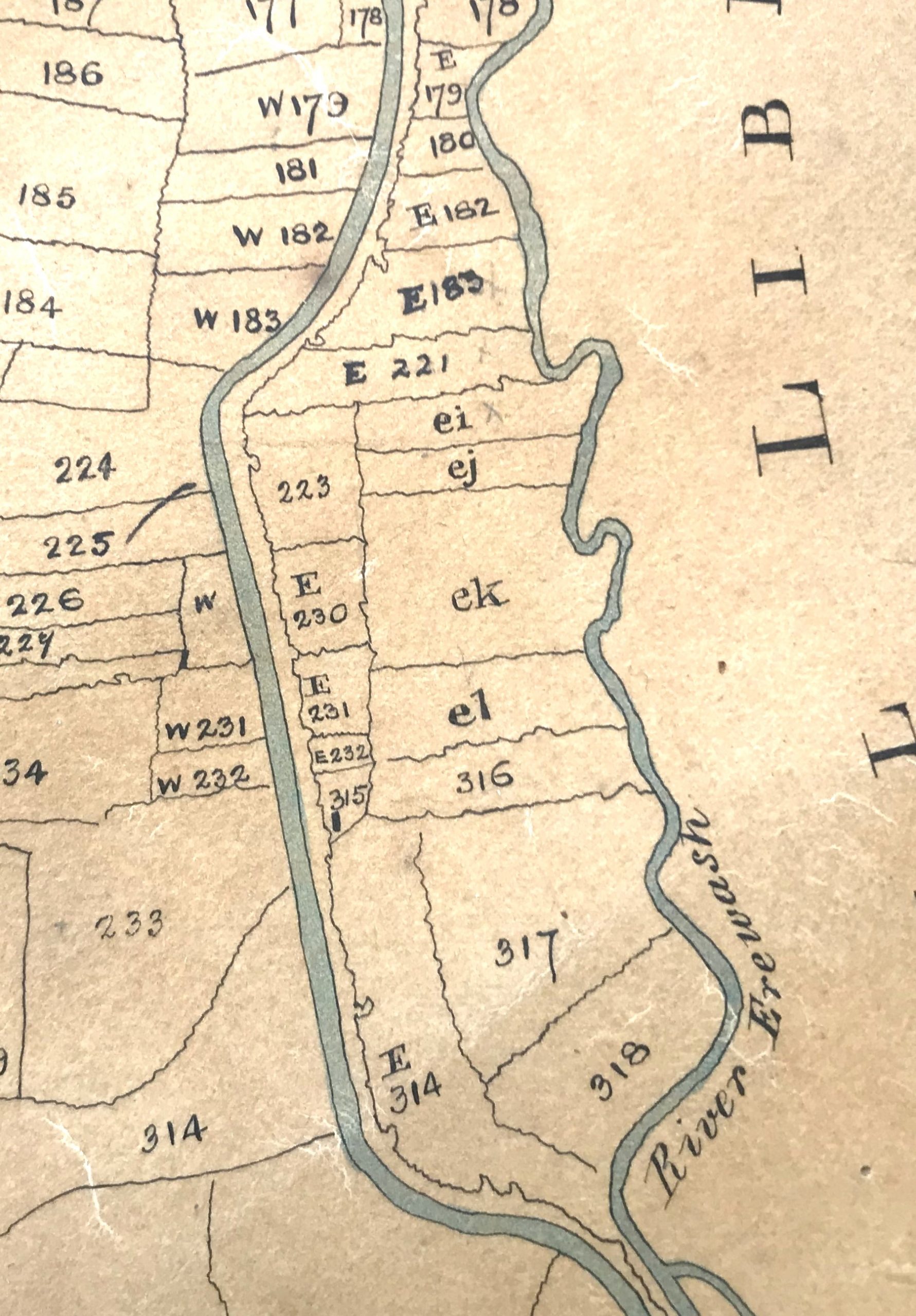
William Gauntley was appointed to draw up a map of the parish to accompany the Enclosure Award. This was completed by 1798 and included all parts of the parish, new and old enclosed land alike. The part of it which concerns us is shown below and is an area largely covered with uninhabited fields, meadows and closes. It lies on the eastern edge of the parish; you can see the direct route of the Erewash canal contrasting with the meandering flow of the River Erewash to its east. If you look very closely you should make out at least one building !!
The Cotton Mill by the canal
The brief history of the Cotton Mill by the canal is one of frequently changing ownership, attempted and accomplished sales, and internal restructuring,
If you had ventured to this area at “Enclosure time” you would have discovered Ilkeston Cotton Mill, operated by a partnership of Thomas Wyer, Samuel Richards, Samuel James, Thomas Hill and Charles Latham junior, under the name of “Wyer, Richards, James & Co.“. They occupied plots 316 (Spicey Meadow) and plot 315 and the adjacent plot of E232 (known as Spicey Close), in which land the company had a house, four tenements and a warehouse as well as their cotton mill (which is shown in plot 315).
We are introduced to this mill in “The History of Ilkeston” (1899) by Trueman and Marston, where it is described as being built by James Wyer and Co. “towards the end of the century“. The authors suggest that the impetus for the mill to be built in Ilkeston lay in a sequence of events and inventions within the cotton spinning industry at this time — James Hargreaves and his “Spinning Jenny” had been driven out of his Lancashire home by local opposition, and, in 1770, he came to nearby Nottingham where the cotton hosiery industry was beginning to thrive. Hargreaves’ name was included in a long list of inventors which also featured Richard Arkwright, John Kay, Lewis Paul and Samuel Crompton — their inventions “turned Ilkeston into a manufacturing town by reason of its proximity to the ancient and extensive trading town of Nottingham“.
The partners in Ilkeston’s Cotton Mill had taken possession of the land to accomodate the mill on May 26th, 1791 and it appears, from property conveyance documents and mortgages, that they began operation between August 1792 and August 1793. The site had been deliberately chosen to access either the waters of the canal or the river, to use as a power source.
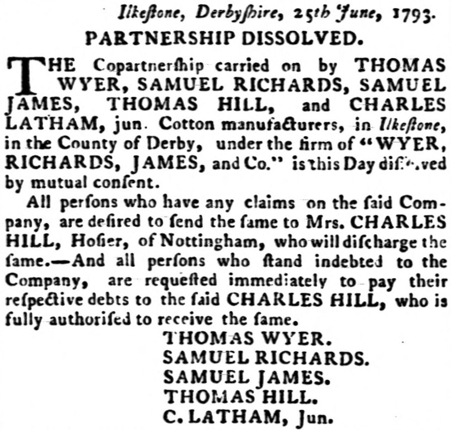
This brief partnership was dissolved in June 1793, though the mill continued to operate.
From the Derby Mercury (July 4th, 1793)
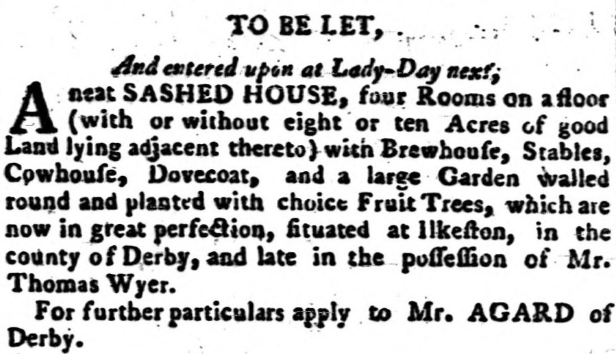
However by February 1795 bankruptcy proceedings against Thomas Wyer had commenced and in March of that year Thomas was planning to leave the town.
From the Derby Mercury (March 19th, 1795)
The bankruptcy proceedings were completed in August of 1797 and two years later (August 20th, 1799) Thomas died in Nottingham, aged 70.
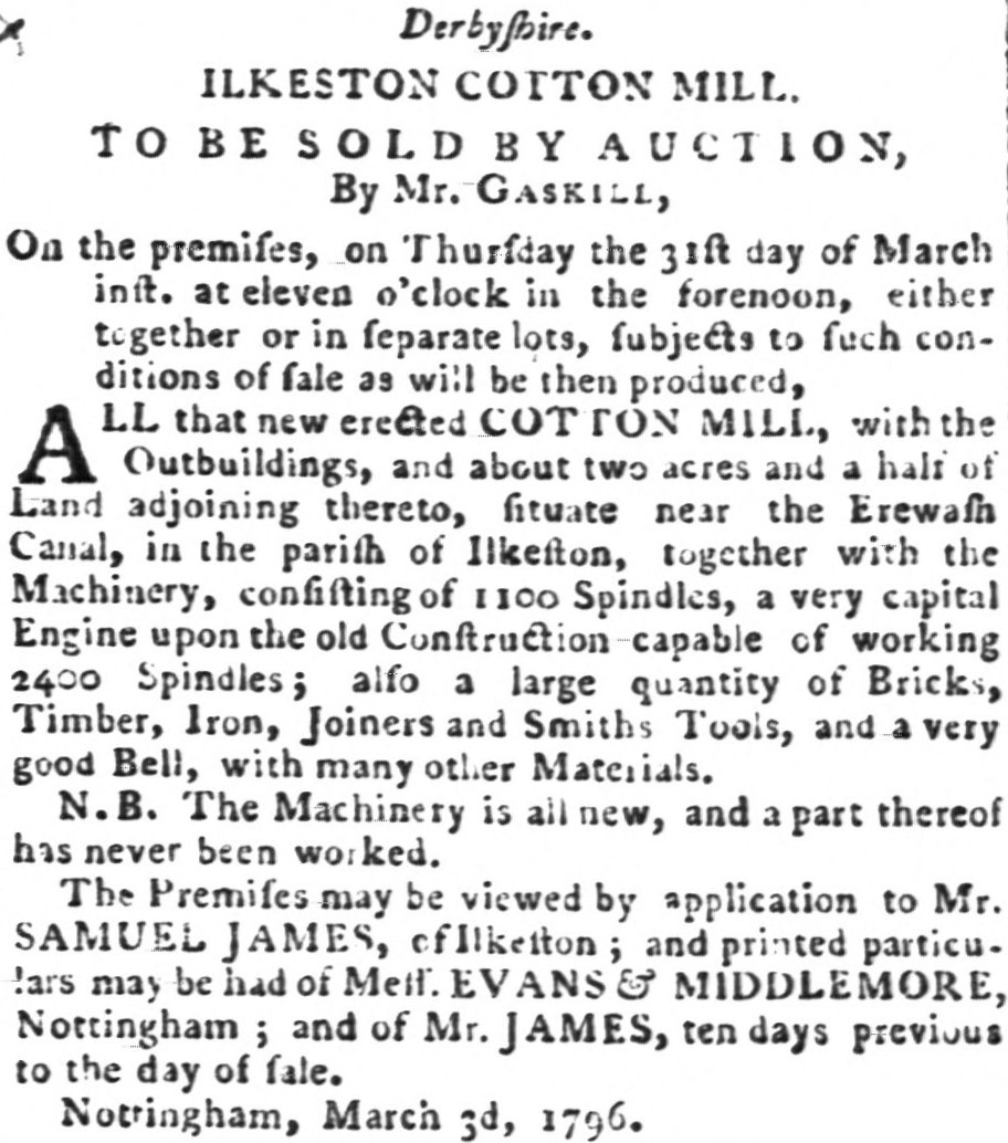
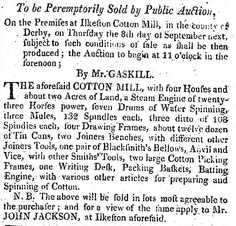
As the bankruptcy proceedings of Thomas Wyer continued and three years after the partnership was dissolved, there was an attempt by Samuel James, one of the erstwhile partners to auction off the mill and its contents.
From the Derby Mercury (March 10th, 1796)
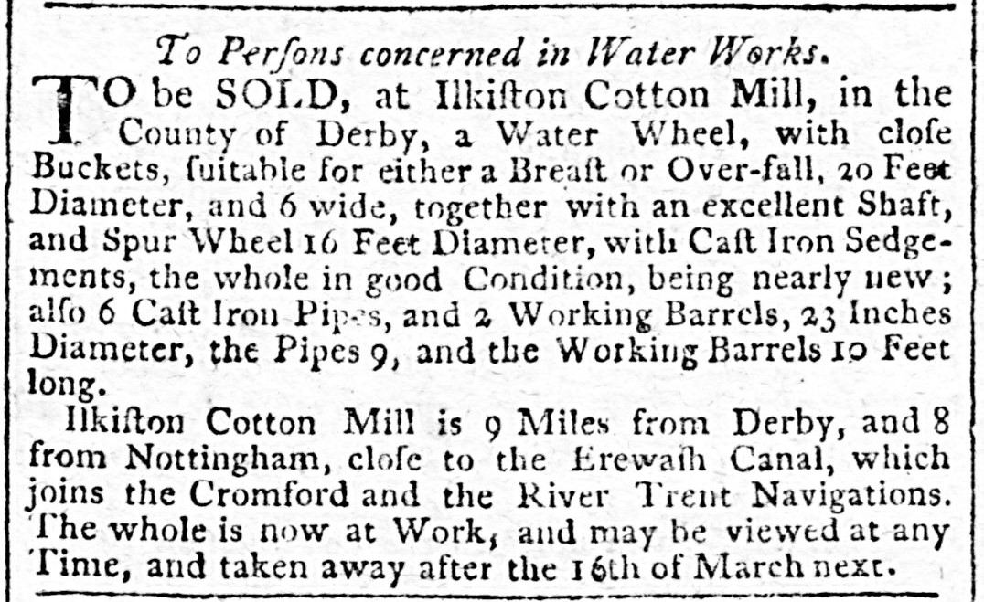
It appears that the auction was unsuccessful and for some time the mill remained unsold, although, as the advert below shows, there were attempts to sell off parts of the mill, especially the water wheel.
From the Derby Mercury (February 14th, 1799)
Enter John Jackson
Then, on March 27th, 1799, William Peel and Edward Lyon agreed to purchase what was left of the mill premises, kept it for a short time, and then sold it on, to John Laykin, Thomas Oldknow and Henry Hollins, on June 6th, 1801. Just a few months later the new owners then put the premises up for sale once more.
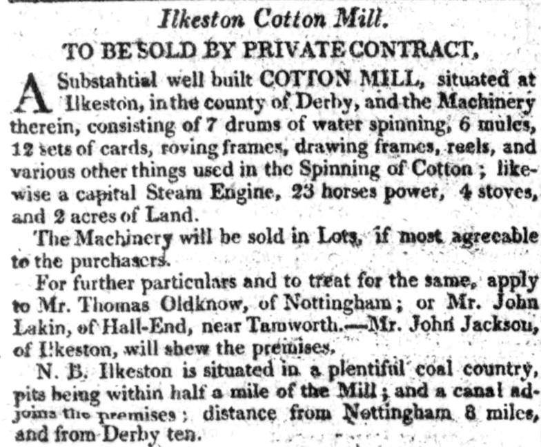
From the Derby Mercury (November 5th, 1801)
Notice how the source of power within the mill had changed and how there was now an emphasis on the availability of coal in the neighbourhood, with the canal now more as a convenient means of transport than a source of power ? Notice too the appearance of John Jackson to escort prospective purchasers around the property — did he live close by ? was he managing the mill ? He almost certainly was living at Ilkeston at the time, possibly in one of the few houses attached on the site of the mill (see the adverts below)
By 1802 the mill remained unsold, despite financial inducements being attached to the sale and suggestions that the building could be converted into “a capital Corn Mill” with “water carriage to any part of the Globe” via the Erewash Canal. More unsuccessful adverts were placed in the local press but someone’s patience was running thin. Eventually the following “warning” was posted in the Derby Mercury …
From the Derby Mercury (August 25th, 1803)
John Jackson was still acting as estate agent, ready to guide any prospective purchasers.
A few months later and it appears that the mill was about to be, or had been, demolished. The mill had effectively ceased production as the Nottingham Courier (April 21st 1804) indicated — it was advertising building materials for sale … “To be sold by private contract. All the materials of the Cotton Mill near Ilkeston. In separate lots. Consisting of bricks, timber, slates, doors and frames, sashed windows, etc. or the whole together in one lot.
Also a quantity of water spinning machinery with Drawing Frames and other articles used in the spinning of cotton; a steam engine of 23 horsepower capable of being made 40 horsepower.
A person will attend the premises on Friday 27th instant and also on every Friday till the whole of the materials be sold, to receive any proposals or to make contracts for sale.
For further particulars apply Mr. Edward Staveley, surveyor, Nottingham, or to Mr Nathaniel Stephenson, Chapel Bar, Nottingham.
Was John Jackson the person “attending the premises on Friday 27th April” ? We can’t be sure but, as it turned out, John was the one to buy the property. In April 1805 he took over the shares of John Laykin and Thomas Oldknow, and then, in May 1806, acquired those of Henry Hollins. During this period John demolished the mill and built a couple of warehouses on the land, where he could carry out his work as a ropemaker. It was at this time that the adjacent ropewalk was set out.
William Gauntley’s survey of 1817
In 1817, a further survey of all the copyhold land in the parish was conducted by William Gauntley though no new map was drawn up. However it is possible to see how the ownership and occupation of some of the parish land had changed during the period 1798 to 1817. And it is also possible to see the land now occupied by John Jackson.
In 1817 he now owned copyhold plots 223 (part of Northfield Close, plus canal rights), E230 (a Croft, plus canal rights), E232 (part of Spicey Close), 315 and 316 (Spicey Meadow). He also occupied, but didn’t own, plot 317 which was owned by West Hallam Poor.
(Post script: John Jackson sold his business to James Potter at the end of 1817 and eventually the premises were acquired by Richard Evans about 1867).
The Rope Walk alias the Ropery
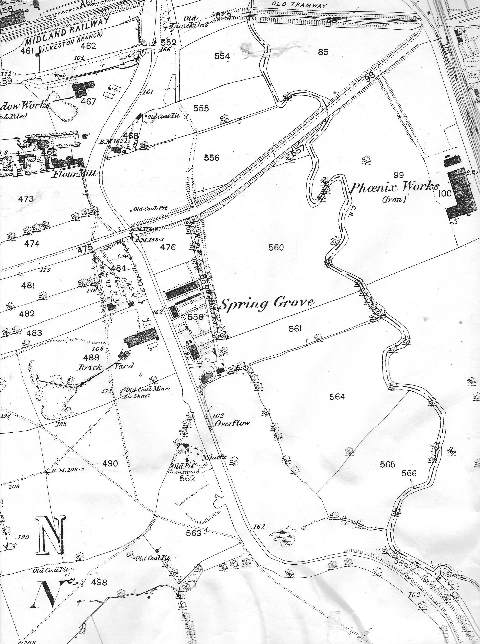
Where was the rope walk originally “set out” by John Jackson ? The map on below shows the Rope Walk area about 1880.
At the eastern end of what was to become Station Road (labelled 475 in the map), close to the river Erewash border with Nottinghamshire and on the eastern side of the Erewash Canal was a collection of houses known as the Rope Walk (or Ropery or Ropery Walk). You can see it named at 559 on the map.
Up to the 1870s this area was pretty inaccessible. Its main approach from Ilkeston was along the east side of the Erewash canal, having crossed that canal by the bridge on (what is now) Awsworth Road.
On the censuses of 1841 to 1881 the Rope Walk accommodated a maximum of a dozen households, with only one or two housing “rope makers” or “rope spinners”
————————————————————————————————————-
Let us now examine John Jackson, his immediate and his wider family. We will start by concentrating upon his son Thomas Jackson and his life in Ilkeston before he left for America

